
Tropical Weather
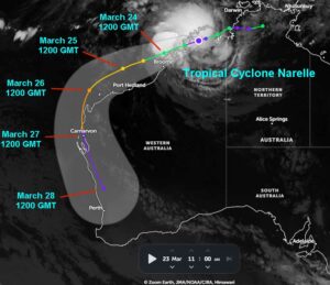
Kansas City, March 25 (World Weather Inc.) – Tropical Cyclone Narelle continued to move parallel to the northern Western Australia coastline today after moving across northernmost parts of Northern Territory and northeastern Western Australia earlier this week. The disturbance will not take a direct path over Port Hedland, Western Australia, though a strong storm surge and localized flooding will be possible in the region possibly promoting minor structural damage. Ocean travel has been and will likely continue to be disrupted along most of the northwestern coast of the nation as the disturbance follows the coast. The storm is expected to intensify while tracking over warm water of the Indian Ocean before reaching the northwest corner of Western Australia late Thursday or early Friday. A shift to the south-southeast will then occur Friday and early Saturday taking the storm across far Western Australia where flooding will be possible from the Learmonth area through Shark Gulf, Geraldton and Perth.
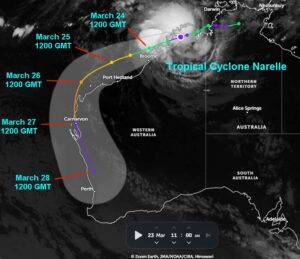
Kansas City, March 23 (World Weather Inc.) – Tropical Cyclone Narelle advanced into the northeast corner of Western Australia this morning. The disturbance will travel along the northern Western Australia coastline through Tuesday before moving just offshore toward the middle of the week. Ocean travel will likely be diverted around the disturbance and strong storm surge may promote minor damage in Port Hedlund. Tropical Cyclone Narelle will then potentially shift southeasterly into western sections of Western Australia Friday and this weekend possibly impacting the Learmonth, Shark Gulf, Geraldton and Perth ports. The rain may improve the moisture profile for some of the winter grain and oilseed areas, but may not be enough to completely fix the moisture deficits.
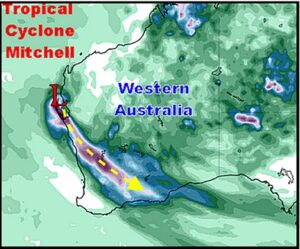
Kansas City, February 9 (World Weather Inc.) – Tropical Cyclone Mitchell was moving into Shark Bay in west-central parts of Western Australia today while producing 60 mph sustained wind speeds. The storm traversed most of the northern coast of Western Australia during the weekend producing some heavy rain and windy conditions. Disruptions to shipping activity resulted and a few coastal areas were roughed up a bit, but most of the nation was spared of much damage. Today, the storm will move through Shark Bay producing rough seas, some damaging wind and torrential rainfall and the moisture will stream into the interior parts of Western Australia’s primary agricultural region tonight into Wednesday.
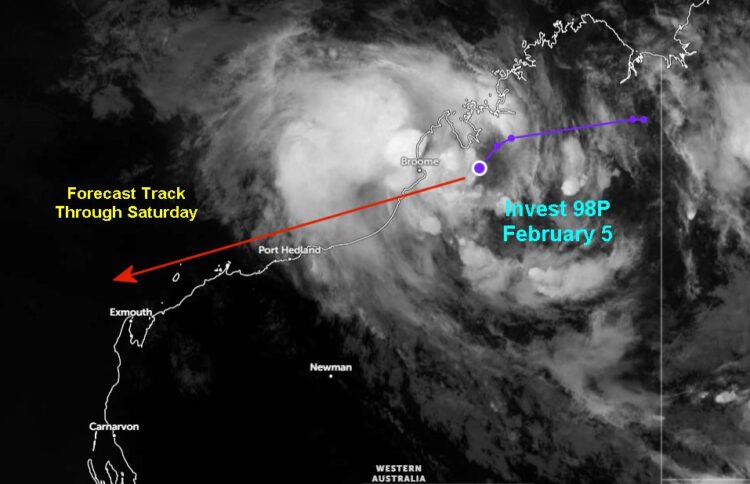
Kansas City, February 5 (World Weather Inc.) – A disorganized tropical system was advancing over the Dampier Peninsula in Western Australia this morning. This disturbance will enter the Indian Ocean later today and slowly advance farther west Friday and Saturday just north of the Western Australia coastline. The disturbance will still generate periods of significant rain along the northern Western Australia coastline, Port Hedlund included. Rain and high storm surge may impact or delay shipping to and out of Port Hedlund and several neighboring areas. Only minor port and infrastructure damage is expected. The disturbance will hug the Western Australia coastline later this weekend before potentially moving inland over central Western Australia early next week.